Friday 18 April 2014

Mountain snobbery and humble pie.

I've lived in Scotland for over 30 years and have been hillwalking on and off for all of that time. I've always dismissed the hills around Luss as small and insignificant and not really worthy of my attention however recently I've read some accounts of walking the Luss hills and this has sparked my curiosity about them, could it be I've been wrong to be so dismissive? I'd been looking for a trip to continue my drive to get back into hillwalking and so last week I made a plan with my occasional walking partner Pat to do a walk and overnight camp starting and finishing in Glen Luss. As our chosen day approached I anxiously watched the forecasts, keen to do the trip even if it meant a little hardship but not if it looked too marginal or dangerous. Ironically the two days we were committed to going were predicted to be quite poor straddled on either side by spells of settled dry sunny weather with light winds, oh well!
I picked up Pat and his friend Dougie and we made the twenty minute journey to Glen Luss. We managed to find a parking spot fairly high up the glen so avoiding a long road walk and the extortionate parking charges that starting in Luss village would have entailed. Boots were donned and rucksacks shouldered and we set off up the first hill (Beinn Eich) just after lunchtime.
We quickly left the road and farm track behind and took to the open hillside which was unrelentingly steep.
The view that began to open up behind us was some compensation and gave us an unfamiliar perspective of the familiar vista of the Luss islands on Loch Lomond. 
Ahead the ridge of Beinn Eich revealed some interesting geological features. 
These provided us with a welcome place for a rest while sheltering from the wind which was becoming stronger the higher we got.
Behind the view continued to open up but we knew these would be our final glimpses of the loch as we could see the clouds growing increasingly closer as we climbed higher up the ridge.


The upper section of Beinn Eich became a nice, well defined ridge and the angle started to ease a little leading to really enjoyable walking. 

As we reached the small summit cairn we finally became immersed in cloud and any views of the surrounding hills became brief. We didn't bother stopping at the top, preferring to push on down the other side to the broad peat hag covered bealach between Beinn Eich and Beinn Lochain. 
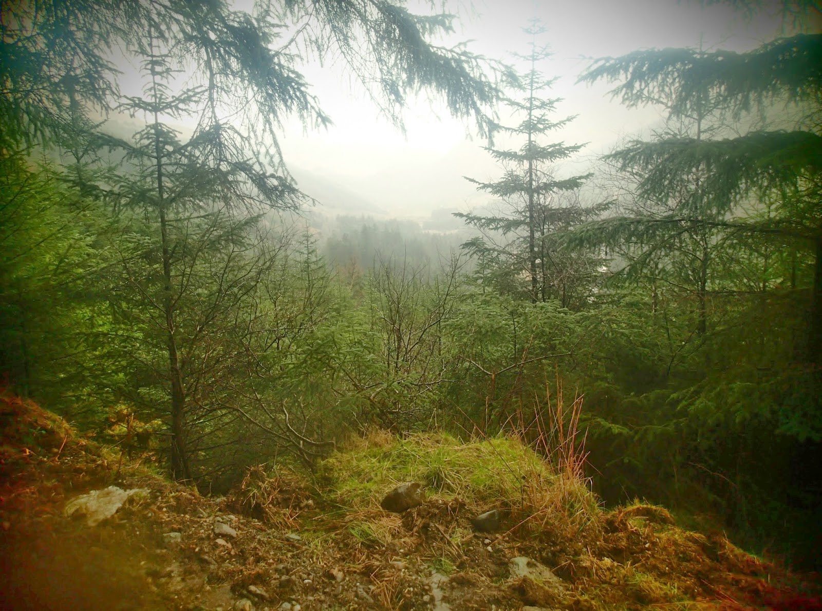
Once we'd descended we dropped briefly out of the cloud again and caught glimpses north to Glen Douglas
and back up Beinn Eich.
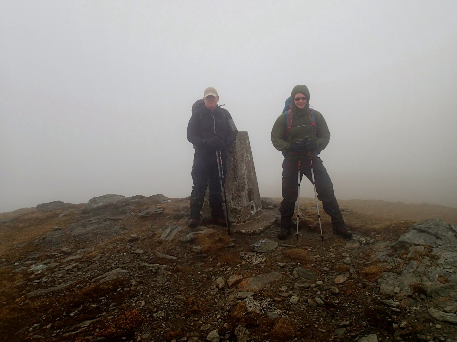
As we climbed up over Beinn Lochain we were once more enveloped in cloud and the visibility dropped to around 20 metres. Eventually we reached the summit of Doune Hill, our most northerly summit and after a few quick summit pictures sought shelter to have a quick bite to eat.

 
Time was getting on, it was already after 5pm and with the thick cloud the light wasn't great. Pat was feeling pretty tired as this was his first walk for over a year so we reluctantly decided to abandon our plan to climb a final summit of Cruach an t-Sidhean and instead skirted around it's flank before dropping down to a lower bealach to search for a campsite for the night.

We knew that the wind was due to rise later and rain was due as well and I tried in vain to get a phone signal to check the latest forecast. With no further information we picked a spot based on what we knew at the time and found a small terrace that was reasonably flat, well drained but with a small burn adjacent for drinking water and set too pitching our tents.

I cooked dinner on my homemade "Shewbox Evo" stove while Pat and Dougie did likewise using more conventional means.
The inevitable downpour started as we were eating so we all beat a hasty retreat to our individual tents for the evening despite the fact that it was still light. I always love being warm and dry in my little haven as the rain beats on the flysheet, my MP3 player provided entertainment for the evening and despite the lack of a phone signal I was able to get decent FM radio reception. 
Every so often a stronger gust would blow through but they were relatively few and far between but as evening turned into night they became more frequent and much stronger until in the early hours we were being battered with almost continuous 45 mph gusts. I learned the next morning that Dougie had to get up and peg out extra guy lines to strengthen his tent but my little Hex coped quite well despite flexing alarmingly at times. It was difficult to sleep with the constant flapping of the tent, I had ear plugs but was reluctant to put them in as I hoped I'd be able to get a little audible warning if tent collapse was imminent! I recorded this video clip during one of the squalls. 


 As dawn broke I wondered whether to get up and start packing up and making breakfast but decided to sit tight in my sleeping bag until I heard the others moving (reasoning that I'd get cold waiting around if they slept late). Soon enough I heard Dougie making breakfast so got up and made a start on the morning routine. The wind was showing no sign of moderating and it was obvious that our plan to continue a high level traverse of a ridge (incorporating more summits) back to Glen Luss wouldn't be safe in the conditions. Over breakfast we amended the plan to walk out down Gleann na Caorainn. It was still a decent walk and after a fairly sleepless night and with tired legs we were happy to do this. After breakfast and striking camp we geared up and said cheerio to our little terrace.

Our route out lay down the glen behind me in this photo with the ridge of Beinn Eich on the left and the ridge we originally planned to take on day two on the right. 
As we lost height the clouds lifted and we got a great view back up to Cruach an t-Sidhean which towered over our campsite.
Lower down the glen we picked up a track which made for easier walking than the tufty clumps of grass and boggy ground we'd negotiated previously and would lead us back towards our starting point of the previous day.

We passed Edentaggart farm and rejoined the farm track. Beinn Eich, Beinn Lochainn and Doune Hill   revealed themselves teasingly in contrast to being cloaked in cloud the previous day. 
After crossing the old bridge we were soon back at the car as the sun came out!
This had been a trip of surprises for me, surprise at the steepness and presence of the hills of Luss and surprise at the deterioration in the weather that forced us to change our plans but in no way was it a disappointment. Anyone used to bypassing Luss and heading for the better known mountains to the north as I have done in the past would do well to stop and have a look I think. 
Here's our GPS track superimposed on a Google Earth image.


Tuesday 8 April 2014

A tour of Ben Donich and the Brack.

Hillwalking was my first love in the outdoors world, I was indoctrinated at an early age by my parents (I believe Loughrigg Fell in the Lake District was my first ascent aged three). I've always particularly enjoyed multiday trips, there's something immensely satisfying to me about carrying all the gear I need to survive on my back while being in remote places. In the past I was a keen Munro bagger here in Scotland and also did some alpine mountaineering. Unfortunately carrying heavy loads on steep terrain took it's toll on my joints and a seriously painful left knee pretty much stopped me hillwalking in the early nineties. Since then I've sporadically returned to the hills, usually just for day walks and have been able to cope with that but I've always hankered for a return to my passion for combining wild camping with exploring remote hills. Years of cycling and walking at work combined with taking glucosamine supplements seem to have improved my knee injury so this winter inspired by internet accounts of backpacking with modern lightweight gear I began accumulating equipment with a view to making a return to the hills. I've always preferred winter hillwalking, the snow covered mountains just seem more majestic and challenging than they do in summer but being realistic winter walking requires more gear and weight so may be a challenge too far for my knee (whose durability remains to be seen).
Last weekend (following a weather curtailed plan for a canoe sailing trip) I decided to get out and test my new kit (as well as my fitness and body!) The forecast was poor, low cloud, rain and drizzle meant that going high would give no chance of seeing anything so after a bit of map browsing I decided to try walking a relatively low level circuit around Ben Donich and the Brack, incorporating an overnight camp somewhere on the route.
I left the car at Ardgarten car park at lunchtime on Saturday and set off along the tarmac minor road which leads to Coilessan house and Loch Long. The rain was heavy and persistent as I set off necessitating waterproofs and as the road climbed up towards the forest track I began to seriously over heat. Soon after leaving the tarmac I turned right up Coilessan Glen.
The cloud and mist hung heavily on the hills as I climbed and I knew I'd soon lose visibility. Higher up the glen I stopped briefly for a sandwich and to shed some clothing before leaving the forest road and taking to the hill track which kicked up steeply towards the hills above.
Soon I reached the stile which accessed the open hillside and the bealach  between Coilessan Glen and the Lochgoilhead side of the peninsula. I'd been here a few times before so despite the poor viz I was able to navigate easily enough until I picked up the wooden marker poles which indicate the route.
As I dropped down the far side a dark line in the mist indicated the start of the forestry above Lochgoilhead and before long I crossed another stile as the path dropped down steeply towards Donich Water.


Once down the initial steep section, the path took on a charming character and even with the mist restricted views it provided an enjoyable stroll down to a bridge and series of waterfalls.


Next I joined the Ben Donich hill track for a while which climbed up steeply before turning off and taking a forest road which traversed round above Lochgoilhead towards the Rest and be thankful.
A long, gently descending track lead me to the foot of Glean Mor the valley that runs up from Lochgoilhead to the "Rest". I passed a couple of likely looking campsites on this section but I felt it was a little too early to stop so pushed on, a decision I was to rue later.
Next I started the long climb up Glean Mor on a forest road that I hoped would provide me with a spot for a decent overnight halt.
Unfortunately the track had been resurfaced and so all the lay byes that I'd imagined would provide a grassy, level site for my tent were covered in road stone. There was nothing for it but to continue on in the fading light in the hope of finding a decent spot. Eventually the zig zags that signify the top of the tarmac road up Glean Mor came into sight and I still hadn't found anywhere to stop.


As the last of light faded I turned downhill from the top of the "Rest" and set off down Glen Croe. At this point I had walked way past the halfway point that I'd intended stopping at so I began to contemplate completing the circuit and driving home that night. Fortunately at the last minute I came across a picnic area at the side of the track with just enough space to pitch my tent on the edge of a precipice. I was really tired  so was delighted to stop, pitch the tent and make some food. My GPS told me that I'd walked 13.8 miles by the time I stopped.

After a hasty meal I got into my sleeping bag just in time as the heavens opened. It was a damp night with heavy rain at times and a lot of condensation in the tent.
Sunday morning dawned wet as well. I ate breakfast and struck camp during any slight lulls I detected in the downpour.

Then it was simply a matter of walking the remaining two and a half miles back to the car.

Here's my GPS track superimposed on a Google Earth image.