Monday, 25 August 2014

For all the cows.


This last weekend I'd hoped to be paddling my sea kayak into Barrisdale in Knoydart to meet up with Rich (Shewie) and Pete who are walking the Cape Wrath Trail over the next few weeks and while I was there taking the opportunity of bagging a couple of Munros that I haven't done. Alas, work intervened again cutting my four days off down to two (which wouldn't have been enough time for that plan). Instead I decided to finally try to get to an island at the northern end of Loch Lomond that I've been intending to visit for ages. 
Island I Vow (or Ellan Vhow or  Eilean a' Bhò  as it's also known) is a small island that's not very obvious from the main A82 road but it has the remains of a castle on it that was once home of the clan MacFarlane. The MacFarlanes were known for cattle rustling and there is speculation that the abductees would often be hidden away on the island (one theory is that the islands name stems from a translation of "Island of the Cow" because of this). The castle was built by the MacFarlanes to replace their original stronghold on Inveruglas Isle which was destroyed by Oliver Cromwell's army in 1654 (due to the clan's loyalty to the Stuart cause).
The two day window of opportunity that I had would be plenty of time to launch at Tarbet and paddle sail north to Island I Vow, camp nearby and return the next day. It was also a great chance to try out a new smaller 25sq ft Solway Dory Expedition Rig that I've recently acquired in a bid to get back to basics with my plastic canoe.
After faffing about on Saturday morning I finally set off to drive to Tarbet after lunchtime. I'd hoped to park at Tarbet pier but the car park was full so I carried on north a little way and was lucky to get a space in a lay by just opposite Tarbet Isle. I got on the water as quickly as I could but it was still almost three by the time I got going. I put the sail up straight away but the wind was light and variable so I ended up dropping it again and paddling across to the eastern shore to get away from the traffic noise.
 
Once across the loch the wind freshened from the north west and I was able to paddle sail again. The new rig performed just as I'd hoped it would, giving decent ability to windward while having less heeling effect than the taller bermudan rig. In pure sailing terms it lost out a little in terms of how high into the wind it would point but for sailing without a rudder it felt very benign and manageable and the paddle strokes used for steering made up a little for the slightly reduced performance.
As time went by the wind continued to freshen giving exciting, splashy sailing conditions that necessitated more athletic efforts to maintain an even keel.

 The sailing was great fun but quite strenuous. The wind strength peaked as I drew level with Inversnaid and I felt that I needed to stop for a stretch of the legs and to reassess. I landed at Inversnaid boathouse where there is an informal campsite used by people walking the West Highland Way.
I had a drink and a rest and pondered my options. I could camp at Inversnaid and try to reach Island I Vow the next day or I could push on. The wind was quite strong now with squally spells of F4 and  wind blown chop that had seen a few waves come over the side of the canoe and a few sketchy moments and it was already six o'clock in the evening. Against that, stopping would leave a lot to do  the following day and may lead to a failure to reach my destination. I studied the map and realised that it was only another two miles to the island. That settled it, I decided to drop the sail and paddle the next section of the loch that ran past some steep rocks that swept straight down into the water leaving no place to land. It would be hard work but at least I wouldn't be risking a capsize and if it was too hard I could turn round and run back down wind back to Inversnaid. I dropped the rig (mast and all) which stowed easily in the canoe and set off paddling hard. I had to "switch," that is paddle a couple of strokes on one side of the canoe then a few on the other rather than paddling on one side as I normally do. This technique is more efficient but not as elegant but was necessary to make any headway into the wind. I gradually rounded the rocky section that I'd been worried about and the wind began to moderate a little so I landed briefly and put the sail back up, anything for a bit of help! Eventually the island came into view in the distance (visible in the pictures below). 

My thoughts turned to setting up camp, I'd thought that I'd camp on the shore just north east of the island where I knew there was a beach and flattish meadow but I couldn't resist landing on the island first for a look.
What greeted me was a perfectly level campsite in the interior of the island just a little way from the castle and I had the island to myself. Furthermore I could see some speed boats beached at the meadow that I'd intended using so I decided to camp on the island. Setting up camp took second place to exploring the castle remains though.


I'd read about the dungeon and the entrance was immediately apparent, I couldn't resist a look. It was surprisingly dry inside despite the dilapidated state of the castle remains above and I could see why it had been home to a hermit in the nineteenth century.


Curiosity satisfied I went back to set up camp and make something to eat before it went dark.
After eating dinner I fed my little woodgas stove with odds and ends of twigs that were lying around  (in lieu of a proper fire) before going to bed.
Having studied the forecast I knew that my best chance of favourable winds on Sunday would be to leave in good time so I rose just after seven. The loch was like a mill pond so I ate breakfast and packed up resigned to the fact that I was in for more paddling.
  I left Island I Vow just before nine in lovely conditions (just not lovely conditions for sailing) but it was impossible to be disappointed on such a beautiful morning as I paddled south.

I had the sail up more in hope than expectation but was surprised to note that even in such calm conditions I could still feel a tiny bit of assistance from it. I'd decided to follow the western bank on the way back for a change and were it not for the traffic noise from the busy A82 it would have been a perfect paddle following a series of nice shingle beaches interspersed with pretty little bays. Soon I reached Inveruglas and it's hideous hydro electric power station (and people say windfarms are ugly!)
As I was passing I decided to visit the MacFarlanes other castle on Inveruglas Isle for a few minutes.


As I left the bay at Inveruglas the first hint of a proper breeze appeared on the water so I sailed over to the beach at Cailness for lunch.
That only left me a short hop back across to the west shore again to my parked car after a leisurely lunch.
The weekend gave me a good chance to try out my new sailing rig (which passed the test with flying colours in very varied conditions) and fulfil a long standing ambition to explore some of the less frequented northern end of Loch Lomond which is well worth a look and is very different in character to the more popular southern end.


Friday, 18 April 2014

Mountain snobbery and humble pie.

I've lived in Scotland for over 30 years and have been hillwalking on and off for all of that time. I've always dismissed the hills around Luss as small and insignificant and not really worthy of my attention however recently I've read some accounts of walking the Luss hills and this has sparked my curiosity about them, could it be I've been wrong to be so dismissive? I'd been looking for a trip to continue my drive to get back into hillwalking and so last week I made a plan with my occasional walking partner Pat to do a walk and overnight camp starting and finishing in Glen Luss. As our chosen day approached I anxiously watched the forecasts, keen to do the trip even if it meant a little hardship but not if it looked too marginal or dangerous. Ironically the two days we were committed to going were predicted to be quite poor straddled on either side by spells of settled dry sunny weather with light winds, oh well!
I picked up Pat and his friend Dougie and we made the twenty minute journey to Glen Luss. We managed to find a parking spot fairly high up the glen so avoiding a long road walk and the extortionate parking charges that starting in Luss village would have entailed. Boots were donned and rucksacks shouldered and we set off up the first hill (Beinn Eich) just after lunchtime.
We quickly left the road and farm track behind and took to the open hillside which was unrelentingly steep.
The view that began to open up behind us was some compensation and gave us an unfamiliar perspective of the familiar vista of the Luss islands on Loch Lomond. 
Ahead the ridge of Beinn Eich revealed some interesting geological features. 
These provided us with a welcome place for a rest while sheltering from the wind which was becoming stronger the higher we got.
Behind the view continued to open up but we knew these would be our final glimpses of the loch as we could see the clouds growing increasingly closer as we climbed higher up the ridge.


The upper section of Beinn Eich became a nice, well defined ridge and the angle started to ease a little leading to really enjoyable walking. 

As we reached the small summit cairn we finally became immersed in cloud and any views of the surrounding hills became brief. We didn't bother stopping at the top, preferring to push on down the other side to the broad peat hag covered bealach between Beinn Eich and Beinn Lochain. 
Once we'd descended we dropped briefly out of the cloud again and caught glimpses north to Glen Douglas
and back up Beinn Eich.
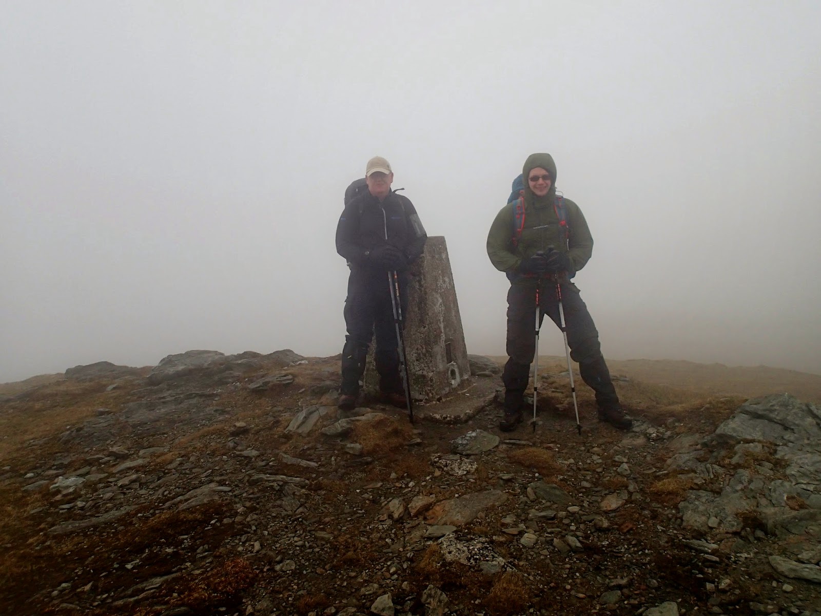
As we climbed up over Beinn Lochain we were once more enveloped in cloud and the visibility dropped to around 20 metres. Eventually we reached the summit of Doune Hill, our most northerly summit and after a few quick summit pictures sought shelter to have a quick bite to eat.

 
Time was getting on, it was already after 5pm and with the thick cloud the light wasn't great. Pat was feeling pretty tired as this was his first walk for over a year so we reluctantly decided to abandon our plan to climb a final summit of Cruach an t-Sidhean and instead skirted around it's flank before dropping down to a lower bealach to search for a campsite for the night.

We knew that the wind was due to rise later and rain was due as well and I tried in vain to get a phone signal to check the latest forecast. With no further information we picked a spot based on what we knew at the time and found a small terrace that was reasonably flat, well drained but with a small burn adjacent for drinking water and set too pitching our tents.

I cooked dinner on my homemade "Shewbox Evo" stove while Pat and Dougie did likewise using more conventional means.
The inevitable downpour started as we were eating so we all beat a hasty retreat to our individual tents for the evening despite the fact that it was still light. I always love being warm and dry in my little haven as the rain beats on the flysheet, my MP3 player provided entertainment for the evening and despite the lack of a phone signal I was able to get decent FM radio reception. 
Every so often a stronger gust would blow through but they were relatively few and far between but as evening turned into night they became more frequent and much stronger until in the early hours we were being battered with almost continuous 45 mph gusts. I learned the next morning that Dougie had to get up and peg out extra guy lines to strengthen his tent but my little Hex coped quite well despite flexing alarmingly at times. It was difficult to sleep with the constant flapping of the tent, I had ear plugs but was reluctant to put them in as I hoped I'd be able to get a little audible warning if tent collapse was imminent! I recorded this video clip during one of the squalls. 


 As dawn broke I wondered whether to get up and start packing up and making breakfast but decided to sit tight in my sleeping bag until I heard the others moving (reasoning that I'd get cold waiting around if they slept late). Soon enough I heard Dougie making breakfast so got up and made a start on the morning routine. The wind was showing no sign of moderating and it was obvious that our plan to continue a high level traverse of a ridge (incorporating more summits) back to Glen Luss wouldn't be safe in the conditions. Over breakfast we amended the plan to walk out down Gleann na Caorainn. It was still a decent walk and after a fairly sleepless night and with tired legs we were happy to do this. After breakfast and striking camp we geared up and said cheerio to our little terrace.

Our route out lay down the glen behind me in this photo with the ridge of Beinn Eich on the left and the ridge we originally planned to take on day two on the right. 
As we lost height the clouds lifted and we got a great view back up to Cruach an t-Sidhean which towered over our campsite.
Lower down the glen we picked up a track which made for easier walking than the tufty clumps of grass and boggy ground we'd negotiated previously and would lead us back towards our starting point of the previous day.

We passed Edentaggart farm and rejoined the farm track. Beinn Eich, Beinn Lochainn and Doune Hill   revealed themselves teasingly in contrast to being cloaked in cloud the previous day. 
After crossing the old bridge we were soon back at the car as the sun came out!
This had been a trip of surprises for me, surprise at the steepness and presence of the hills of Luss and surprise at the deterioration in the weather that forced us to change our plans but in no way was it a disappointment. Anyone used to bypassing Luss and heading for the better known mountains to the north as I have done in the past would do well to stop and have a look I think. 
Here's our GPS track superimposed on a Google Earth image.